Master’s Thesis

Digging a Hole
Through Earth

Besides playing with the desktop version of the SuperTunnel Simulator, people could interact with a physical shovel (a tangible interface) to control the direction of the tunnel – as part of an installation in science museums.

Where in the world would you end up if you were to dig in a certain direction?

🎓 Part of my thesis on Interactive Data Physicalizations

Context

For thousands of years, physical objects have been used to represent data – like using pebbles to account for votes in ancient Greece. Such representations, especially newly computer-supported ones, became the focus of an emerging field called data physicalization.

As part of my master’s in interaction design, I explored how data physicalization and tangible and embodied interaction could be combined. More specifically, I studied how an object might convey data not through its shape, but only through our interaction with it.

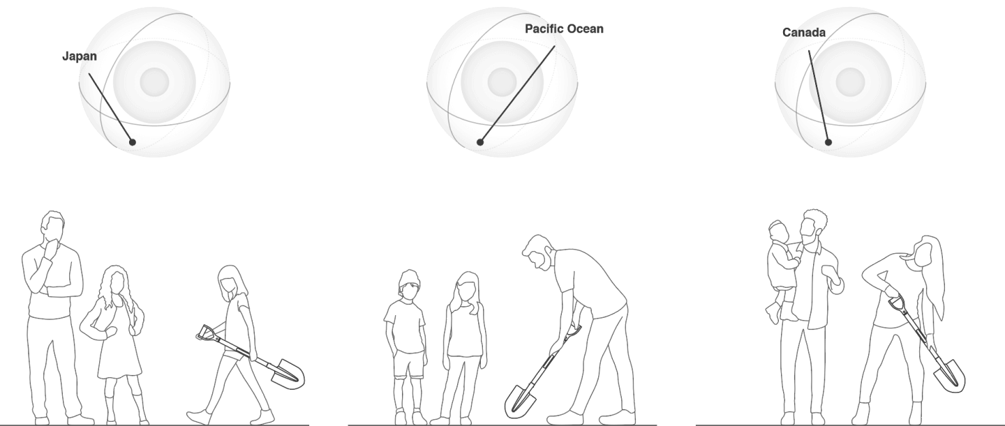
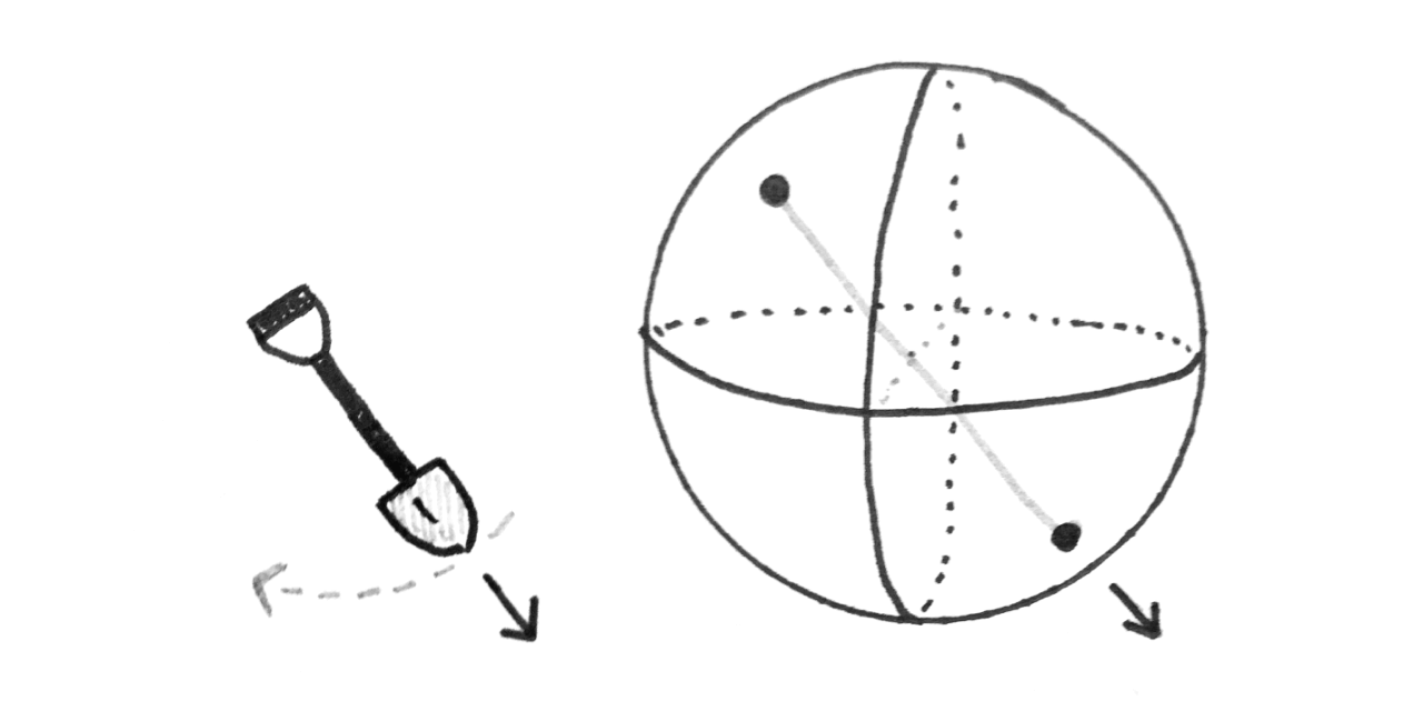
I proposed a tangible and embodied artifact (a shovel equipped with orientation sensors) that could be used by visitors of Earth sciences museums.

By pointing the shovel to the ground at different angles, visitors could learn where in the world they would end up, if they were to dig a hole towards that direction.

Hand-drawn sketch of a physical shovel controlling a simulated tunnel through the globe

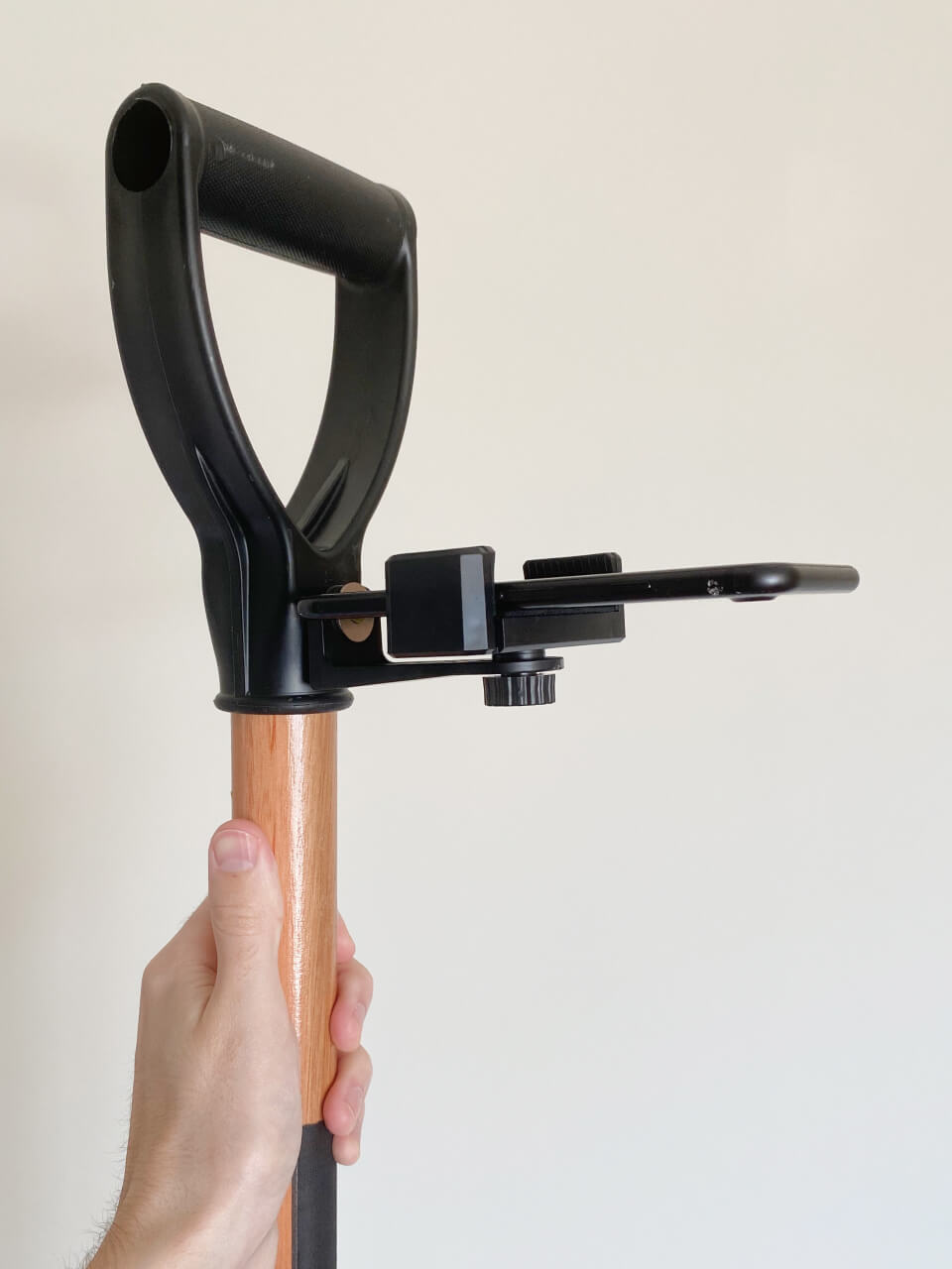
In order to perform such calculation, I created SuperTunnel Simulator – an application that would be running in an electronic device attached to the shovel.

Don’t you have a shovel at hand?

Don’t worry! You can check a standalone version of the simulation at supertunnel.app, which runs on both desktop and mobile devices.

Process

Well, that shovel idea didn’t come out of thin air.

In order to ideate based on a concrete use situation, I focused on museum visitors – more specifically, visitors of the Geosciences Museum of University of São Paulo.

Besides interviewing museum staff, I have also talked to researchers and practitioners of related areas – as depicted in the diagram below:

Diagram representing remote interviews conducted with three experts
Interviews were conducted with Arielly Tomazia Costa (Geosciences Museum mediation intern), Júlia Giannella (data visualization researcher) and Fernanda Silva (primary school teacher).

The interviews were truly insightful – and I condensed them into 5 guidelines for my project – which were phrased as the following pedagogic principles:

Diagram representing the five pedagogic principles that were defined based on the interviews
  • Ignite visitors’ curiosity through exploration.
  • Associate new concept with day-to-day (or personal) reference.
  • Encourage social interaction (experience exchange, discussion).
  • Stimulate hypothesis formulation (not just answer questions).
  • Guide visitors into locating themselves geographically.

After generating dozens of project ideas that could address the above guidelines, the “magic shovel” idea sounded the most promising.

In order to better communicate it, I illustrated different people using the shovel, as well as a visual representation of the simulated tunnel on a globe:

Three schematic drawings of people (both adults and children) handling the shovel (tangible interface) to simulate a tunnel in that direction
Human figures adapted from dimensions.com

Feedback on that idea was mostly positive, so I moved on to creating a working prototype. The first approach was to use an Arduino board attached to the shovel:

Short video footage of an Arduino with attached electronic components (LED 8x8 grid and battery) to experiment with potential options for giving visual feedback to users.
Controlling virtual globe and tunnel with motion sensors connected to an Arduino Uno board. The board was connected to the browser (Google Chrome) via serial port, to send orientation data from an IMU module.

Experimenting with Arduino. On the left, a wave pattern would indicate the user was pointing to an ocean, while an arrow would indicate land. On the right, a virtual tunnel would be controlled using motion sensors.

Despite the promising experiments with Arduino, I ran into some technical issues (like the orientation data not being precise enough). So I decided to create the next prototype using the built-in sensors of a smartphone.

After experimenting with an old iPhone, the orientation data seemed more realiable, North direction was easier to obtain and GPS was already built in. Now, I needed a way to attach the phone to the shovel:

Photo of phone holder attached to the handle of the shovel
A common phone holder was screwed into the shovel, taking advantage of a previous hole on the handle.

Besides providing more accurate sensor readings, the phone’s screen was also beneficial, as a way to provide vistors with visual feedback.

By running supertunnel.app on the phone attached to the shovel, visitors could see (on the screen) their hypothetical destination be updated as they moved the shovel.

The following video represents a potential visitor (in this case, myself) playing with the shovel and simulating a tunnel from Brazil to China, Russia, Australia, India and many other countries.

The globe overlay displays the actual direction the shovel was pointing to.

Within the museum, there could be a projection of the 3D globe, animated in real time according to the shovel’s movement.

Finally, even though the protoype was not tested in a real museum scenario (due to the pandemic), early feedback from participants sounds promising.

Responses indicate such interaction might influence learning not by strictly teaching content — but by igniting visitors’ curiosity and stimulating hypothesis formulation.

In a broader sense, my thesis points to opportunities on investigating ways to convey data not through an objects’s shape, but only through our interaction with it.